Maps
3 previous year questions.
High-Yield Trend
Chapter Questions 3 MCQs
Itanagar
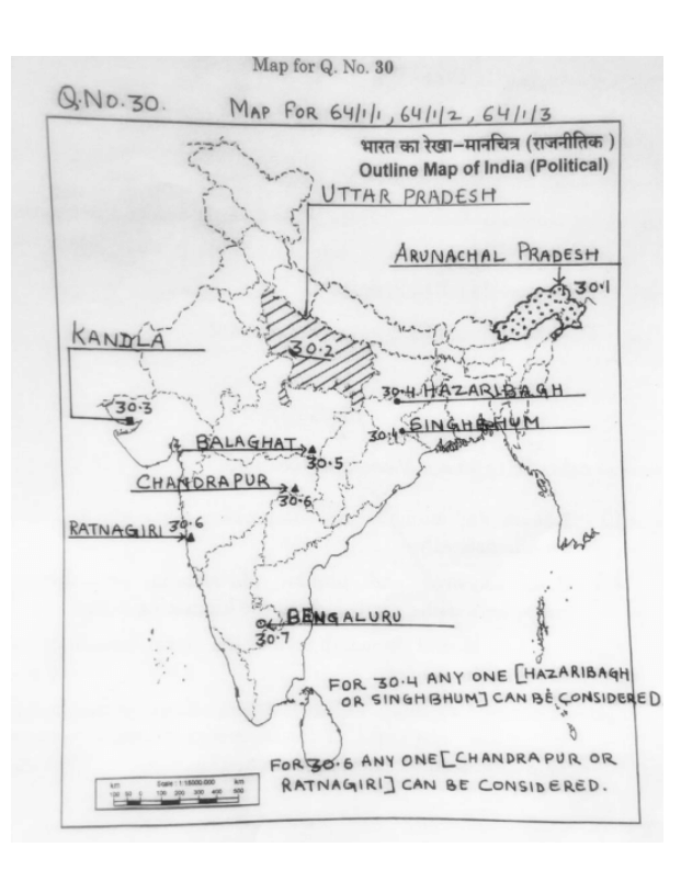
On the given political outline map of India, locate and label any five of the following seven geographical features with appropriate symbols:
- The state with the lowest population density (2011).
- The state leading in the production of sugarcane.
- A major sea port in Gujarat.
- A copper mining centre in Jharkhand.
- A manganese mining centre in Madhya Pradesh.
- An iron-ore mining centre in Maharashtra.
- An international airport in Karnataka.
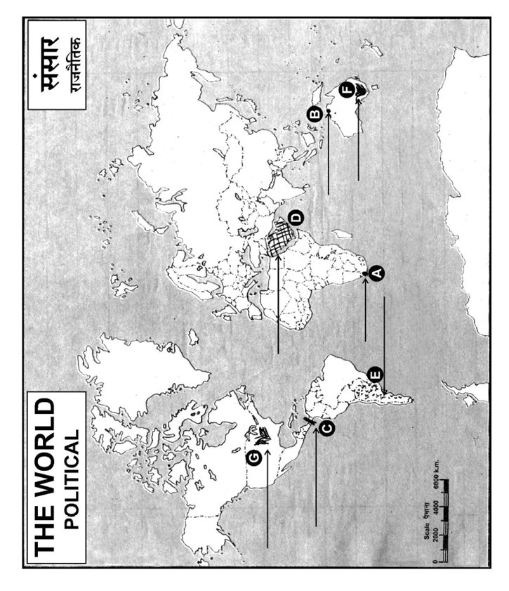
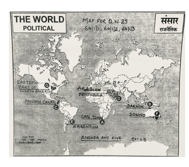
On the given political outline Map of the World, seven geographical features have been marked as A, B, C, D, E, F and G. Identify any five with the help of following information and write their correct names on the lines drawn near them:
- A major sea-port
- A major airport
- An inland waterway
- A major area of nomadic herding
- A major area of commercial livestock rearing
- A major area of extensive commercial grain farming
- A major area of mixed farming
About Maps - CBSE-CLASS-XII
Maps is a vital chapter for CBSE-CLASS-XII aspirants. Mastering the concepts covered in this chapter is essential for securing a top rank.
By rigorously practicing the previous year questions associated with this chapter, you can identify high-yield topics, understand the examiner's perspective, and boost your confidence during the actual exam.
Frequently Asked Questions
Why focus on Maps PYQs?
Analyzing PYQs for this specific chapter reveals the most frequently tested concepts and the typical complexity of questions, allowing you to tailor your study plan efficiently.
How to best use this analysis?
Review the topic breakdown to see which sub-topics within Maps carry the most weight. Then, tackle the questions iteratively to solidify your understanding.